How Big, How Blue, How Beautiful: Sky and Ocean Converge on Queensland’s Moreton Island
BETWEEN two worlds life hovers like a star,
’Twixt night and morn, upon the horizon’s verge.
How little do we know that which we are!
How less what we may be! The eternal surge
Of time and tide rolls on, and bears afar
Our bubbles; as the old burst, new emerge,
Lash’d from the foam of ages; while the graves
Of empires heave but like some passing waves.
– Lord Byron
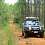
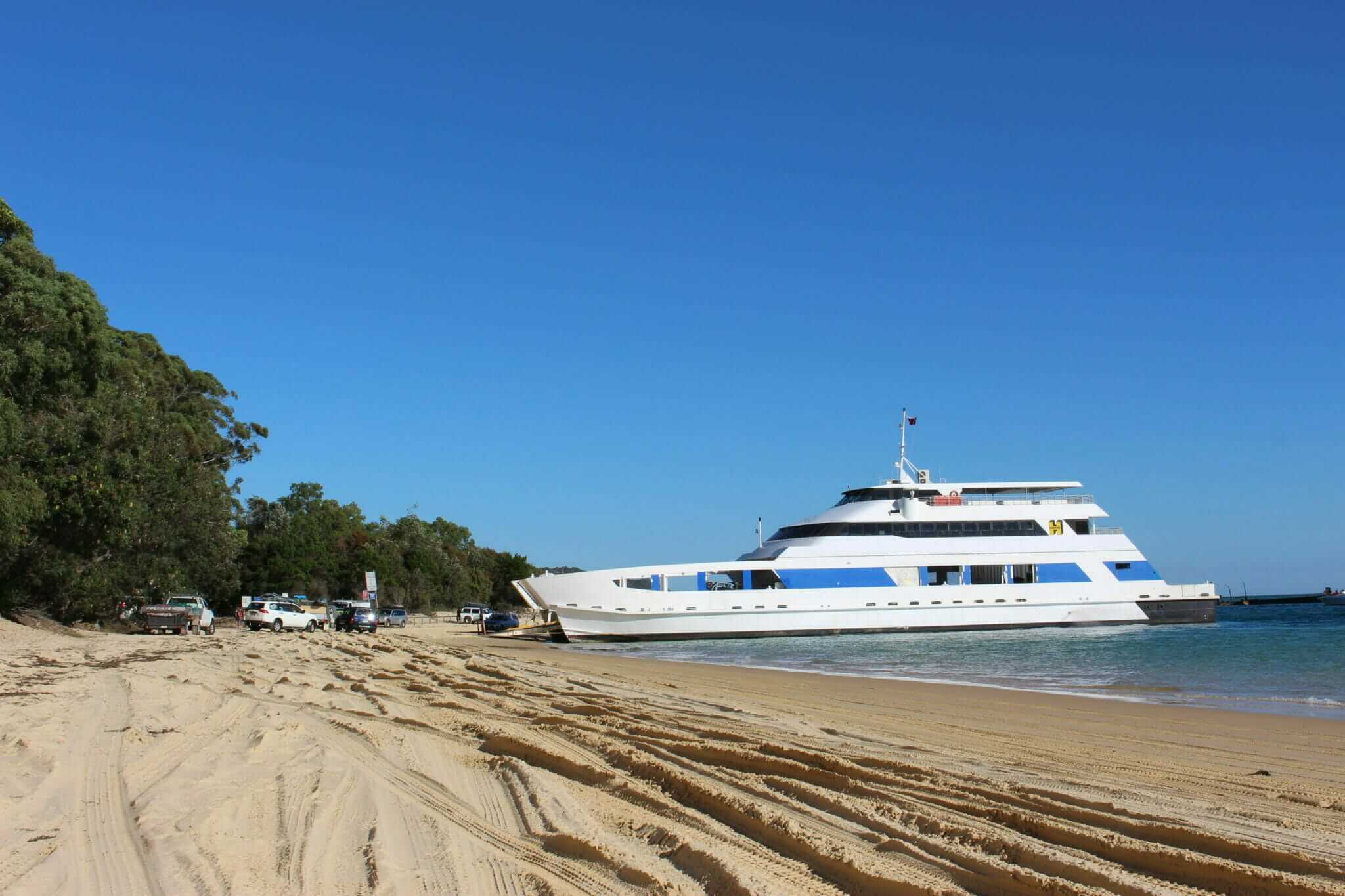
“There are no roads?” exclaimed my mum from the passenger seat.
“Nope, no roads,” I said watching the plank at the front of the MICAT slowly lower. Engines fired up all around us as the two lines of 4WDs prepared to drive off the ferry. “Just sand tracks, but the resort isn’t far.”
My mum was visiting from the US for five weeks and during her stay, and the kids’ school holidays, I had planned a weeklong trip to Tangalooma Island Resort on Moreton Island. The resort was the safety net for my mum who unlike me, didn’t take well to extreme outdoor activities, especially camping. It was a compromise – I was taking the FJ over and planned to use it as much as possible away from the resort, but my Mom would have a nice warm bed waiting for her each night.
“Do people live here?” she asked, gripping the safety handle on the FJ, watching as the 4WDs drove off the MICAT and onto the white, sandy beach.
“I think so,” I said, locking the FJ into 4WD. “I know there’s a town, but they don’t have power or water so it’s not that sophisticated.”
We were last in line and when we finally emerged from the steel belly of the ship, I could see blue water, blue sky and a flurry of boats, jet skis and kayaks in the shallow waters around the Tangalooma wrecks. Southward down the beach the resort sat tucked away behind palm trees. When the tyres finally hit the sand, my mum gasped and with the other hand, gripped the armrest. She looked straight ahead, her lips pursed tightly. She had never been 4WDing before so a ride down the beach was on par with taking a rocket to Mars, and with her daughter driving, she felt even more unsure.
I grew up in the safe confines of cul-de-sacs and mowed lawns in middle-class America on the East Coast. We couldn’t take 4WDs off-road anywhere and most everything was fenced and owned and inaccessible. Australia’s untamed wilderness was for my mum, both terrifying and achingly beautiful. And I hoped that this little adventure would force her to let her hair down a little bit and get wild!
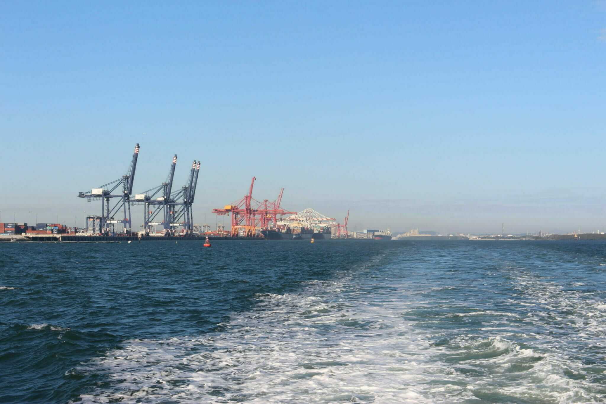
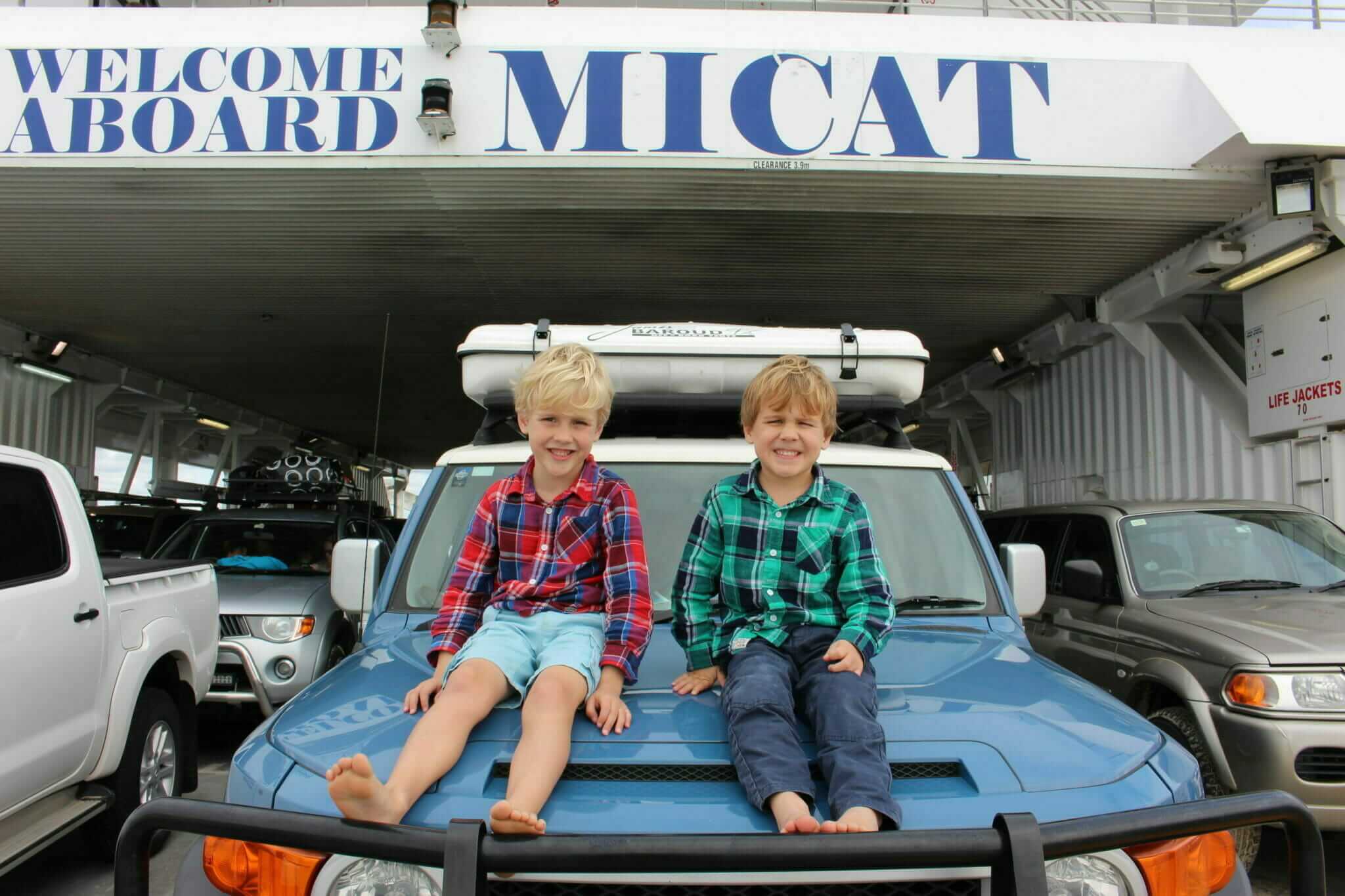
We drove down the beach for only a short while and found the track leading to the resort. It ended at a small parking lot lined along one side with 4WDs. Behind a locked gate, a paved road led towards the resort. I parked the FJ and let the boys out of their car seats. They were still in pyjamas as the ferry left the Port of Brisbane at 8:30 am, and after the 90-minute ride across Moreton Bay, it was still only 10 am. I had booked the cheapest room I could find for the four of us, which was a great rate considering it was school holidays, but I doubted it would be ready this early.
“Do they have bell boys?” asked my mum, standing beside the FJ frantically looking around. In the US ‘resort’ typically meant five-star, full-service, butlers included in your package. This wasn’t going to be like any other resort she had ever stayed in.
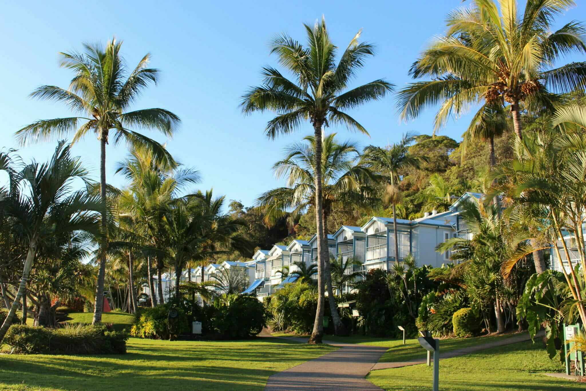
We grabbed a few things and started walking towards where we thought the reception might be. There were no signs, no employees, nobody to tell you what to do and where to go. I ended up chatting to a bloke who was loading up his 4WD to catch the ferry back to Brisbane and he pointed us in the right direction and gave me a map of the island. Winding our way through the resort’s palm-lined pathways, it was obvious that the main buildings were old, but had been shined up over the past year with fresh paint.
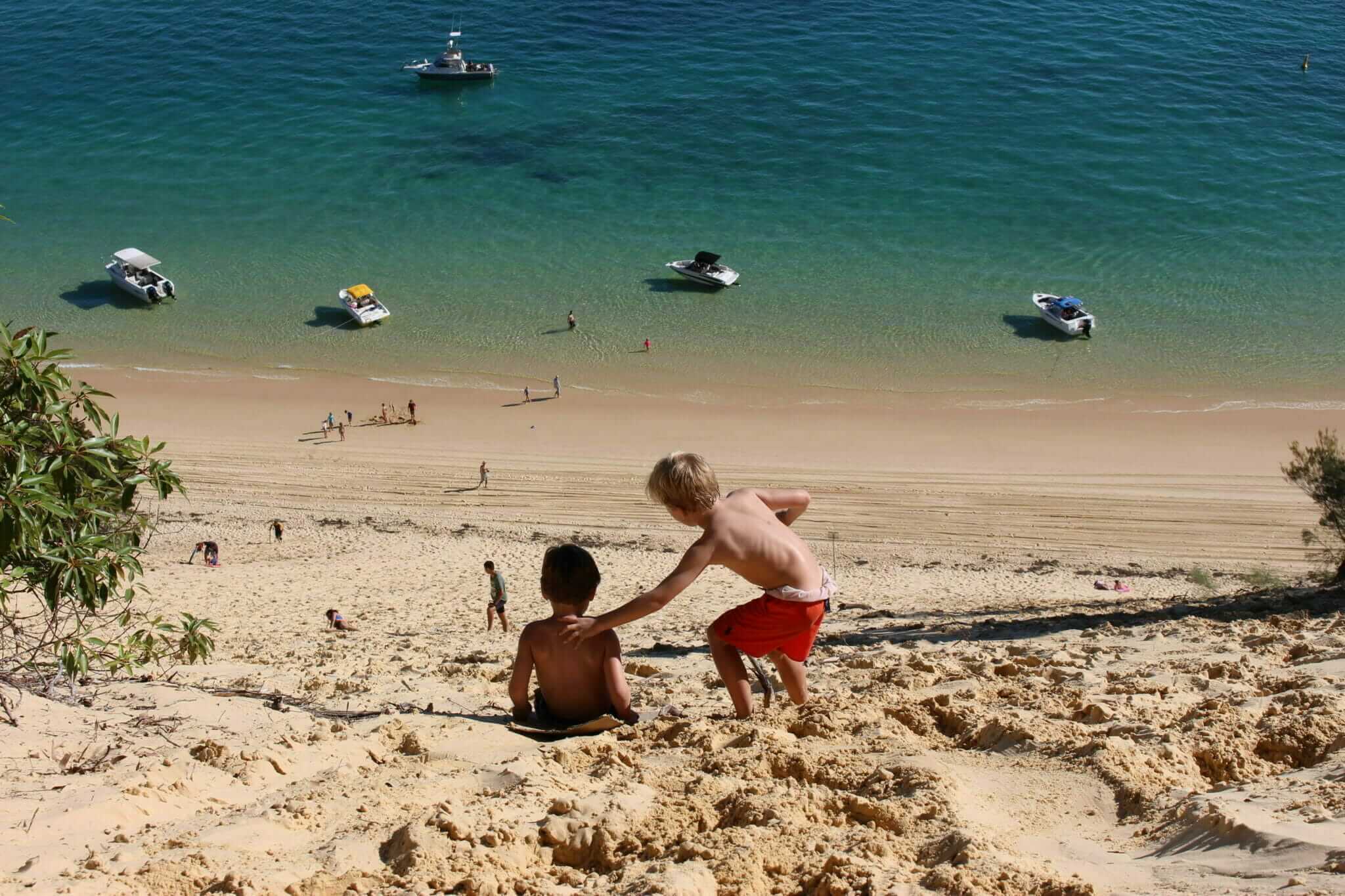
After wandering around the resort searching for reception, we finally found it and were told that someone had stolen the signs hence the confusion, our room was not ready and wouldn’t be until 2 pm, and we could use rusted trolleys to tow our luggage to our room. My mum frowned, but the winter day was a balmy 23 degrees, so after walking back to the FJ (a solid ten-minute hike from reception to the 4WD parking lot) and lugging our bags back to be stored until the room was ready, we jumped back in the FJ and headed off down the beach towards the wrecks to swim.
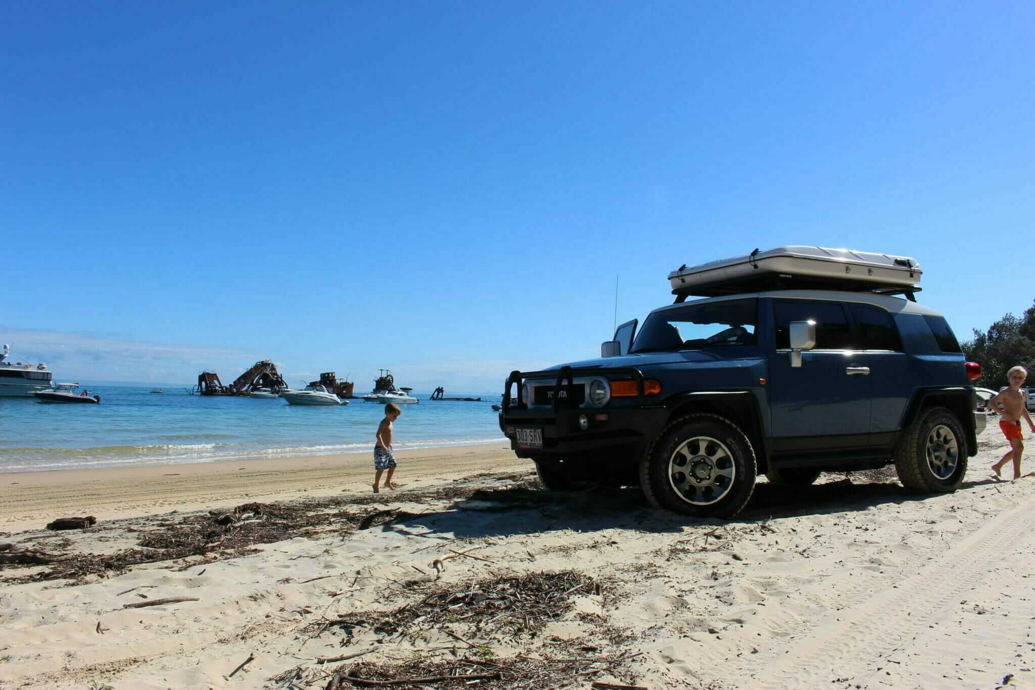
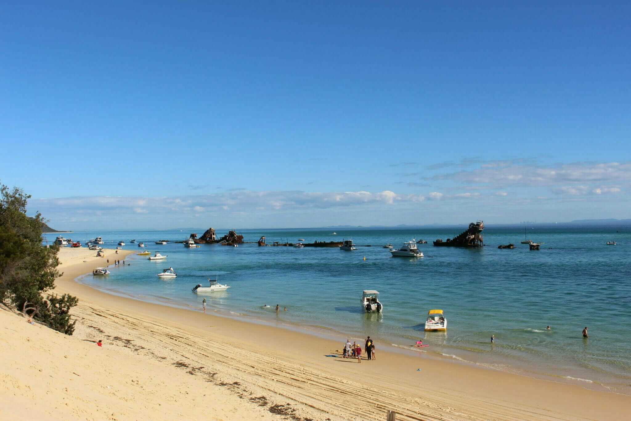
Not far from the resort lies the Tangalooma wrecks, a man-made reef composed of fifteen vessels that were deliberately sunk to form a break wall for small boats.
It’s a rusted conglomeration of old Harbours and Marine Department steam-driven dredges. It makes for an interesting snorkelling spot and serves as the meeting point for harboured boats and 4WDs coming and going on the MICAT. A little further down the beach is a large dune, which you can climb for a great view of the surrounding beach and wrecks.
Moreton’s Sandy Tracks
On our second day on Moreton, we woke up before the sun and hiked our way to the FJ. I had planned a rather ambitious expedition to explore most of the northern half of the island and wanted to cover as much ground as possible in one day (but still make it back to the resort to watch the famous sunset).
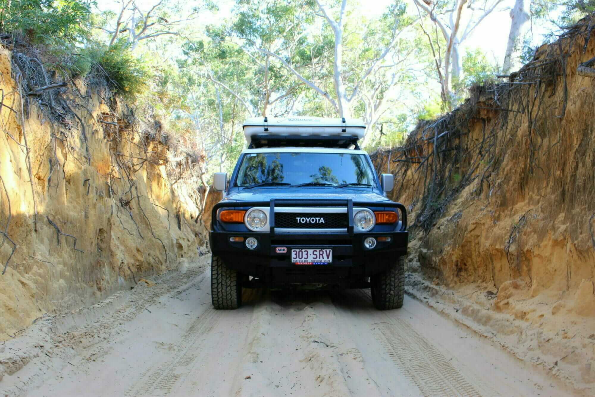
From Tangalooma, we drove north towards the ferry landing to Middle Road track. This track cuts through the centre of the island for 7 km and exits onto the eastern beaches. It’s a stress-free one-way ride that takes you through eucalypt forests littered with grass trees and blooming banksias. It also leads to the Mt Tempest walking track, the highest point on Moreton with panoramic views.
Being stress-free for me didn’t necessarily mean stress-free for my mum. “It’s just like we’re driving in snow,” she said between clenched teeth as we tracked east. She was still nervously gripping the safety handle and staring straight ahead anticipating something dangerous.
“Not really,” I said, bumping along the track. The boys were in the back seat playing with the iPad, unphased and used to being taken off-road. “It’s not like we’re going to hit an icy patch and skid off the track.”
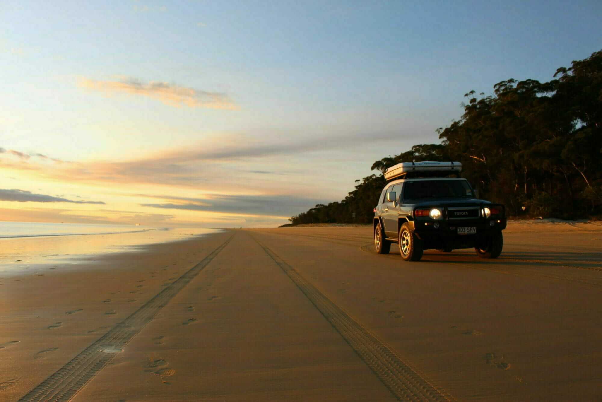
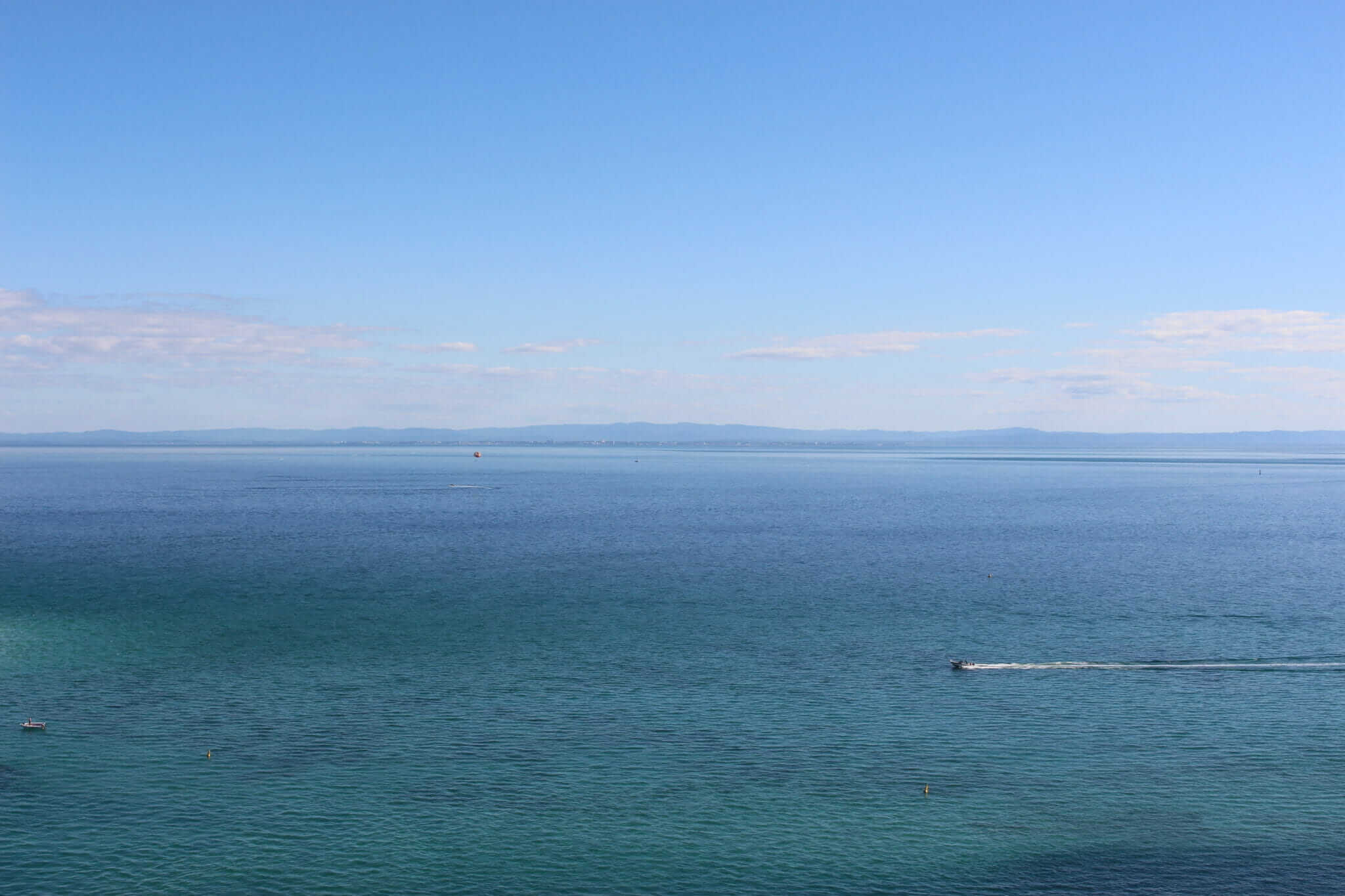
Once we came out of the tree-lined track and onto the wide beaches on the eastern side, she relaxed a little. The sun was bright, the sky was cloudless and deep blue, and the waves rolled in without a breath of wind. It was the middle of winter, but the air was warm. Everything and everywhere was blue; the water, the sky, my FJ.
We went north up the beach toward the lighthouse, passing Eagers Creek and another track that led towards the small town of Bulwar. I planned to check out Blue Lagoon, a natural freshwater lake infused with tea tree oils, formed through the catchments of rainwater over thousands of years when the water table met the ground surface. We turned up the track but came to a deep water spot, a sign issued a warning about dangerous driving conditions. Once my Mom saw this, there was nothing I could do to convince her to keep going. She insisted we turn around, fearing the FJ would get stuck and we would be trapped on Moreton forever. Not having mobile reception here didn’t help my case either. So I turned around and pushed north towards the red cliff face, known as Cape Cliff, at the end of the beach.
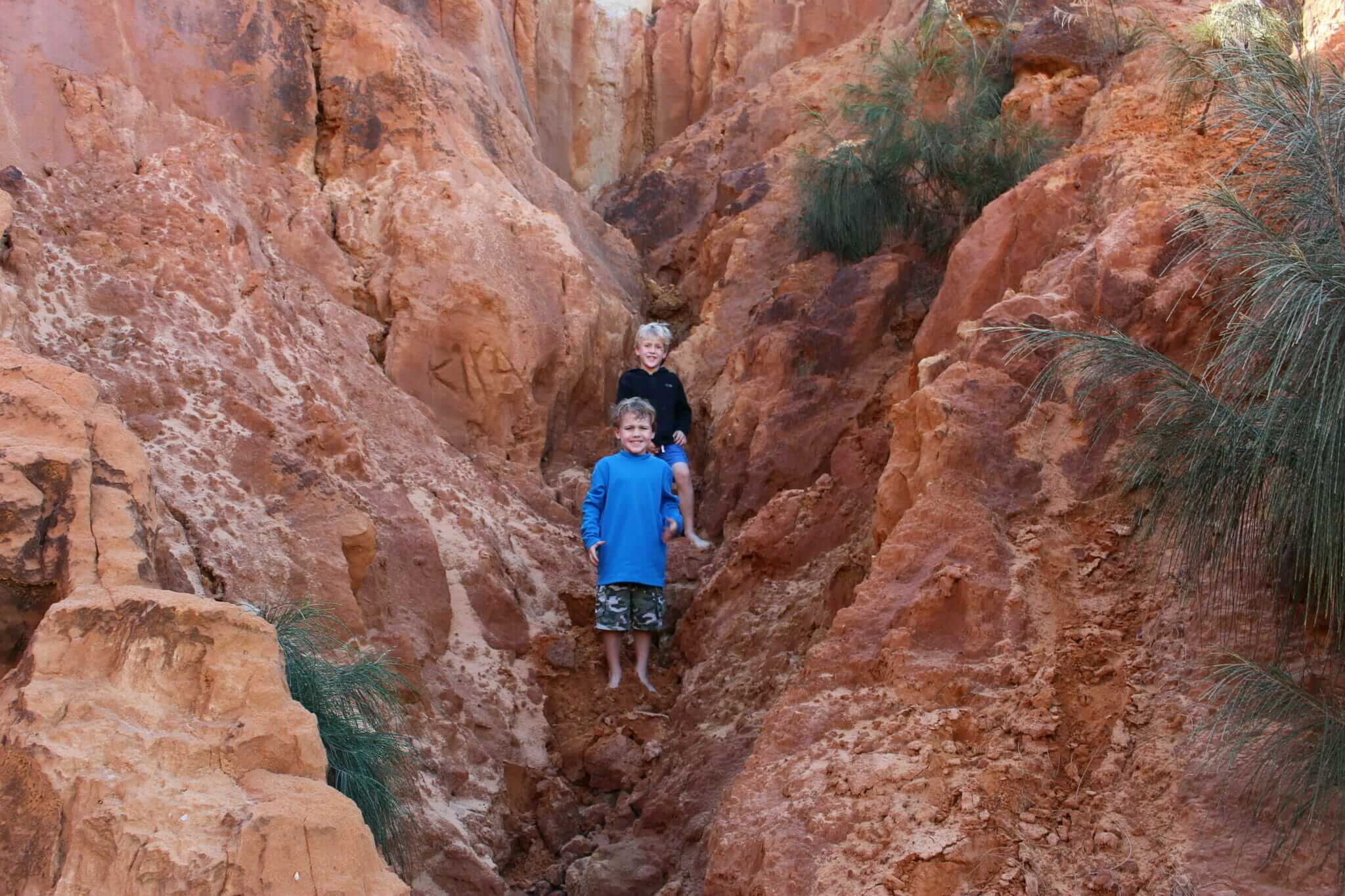
The boys and I hopped out and scampered up the red rocks, leaving my mum behind to splay out on the sand and bask in the sun. Once we made it to the top, the view north looked out across black rocks towards the Cape Moreton Lighthouse. Back down the beach, there was little else besides blue sky and blue water and dunes marching inland covered with spinifex grass. Whales splashed far off in the Pacific, making their migration from Antarctica to the balmy waters of the barrier reef. Below us, a fisherman climbed up from the rock pools, his face smeared white with zinc and a net slung over his shoulder. He stopped once he reached us, my boys both jumped up and down with excitement, begging to see his catch.
As he showed the boys his net full of fish, I found out he lived at Bulwer, there was absolutely no fuel for sale on the island and the best place to swim was the Champagne Pools at North Point, a mere ten minutes down the track. It was warm enough for a swim, so we piled back in the FJ and drove west down the track towards North Point.
I didn’t know you could drive on the beach to North Point, so I parked in the campground and made my two little boys and mother hike 1km to the beach. It was well worth the effort, we passed an old WWII building, formerly used as an armoury. I tried to get the boys interested in the history, but they were already grumpy so we pressed on. The trail led down a hill and through some bush, finally ending at a quiet beach lined with 4WDs, their drivers and passengers enjoying the sun.
“Why didn’t we drive down?” my mum asked, out of breath, her beach bag banging into the side of her legs as she walked.
“You seemed scared, so I thought you’d prefer to walk,” I muttered, smiling to myself. I knew at this point there was not much I could do right.
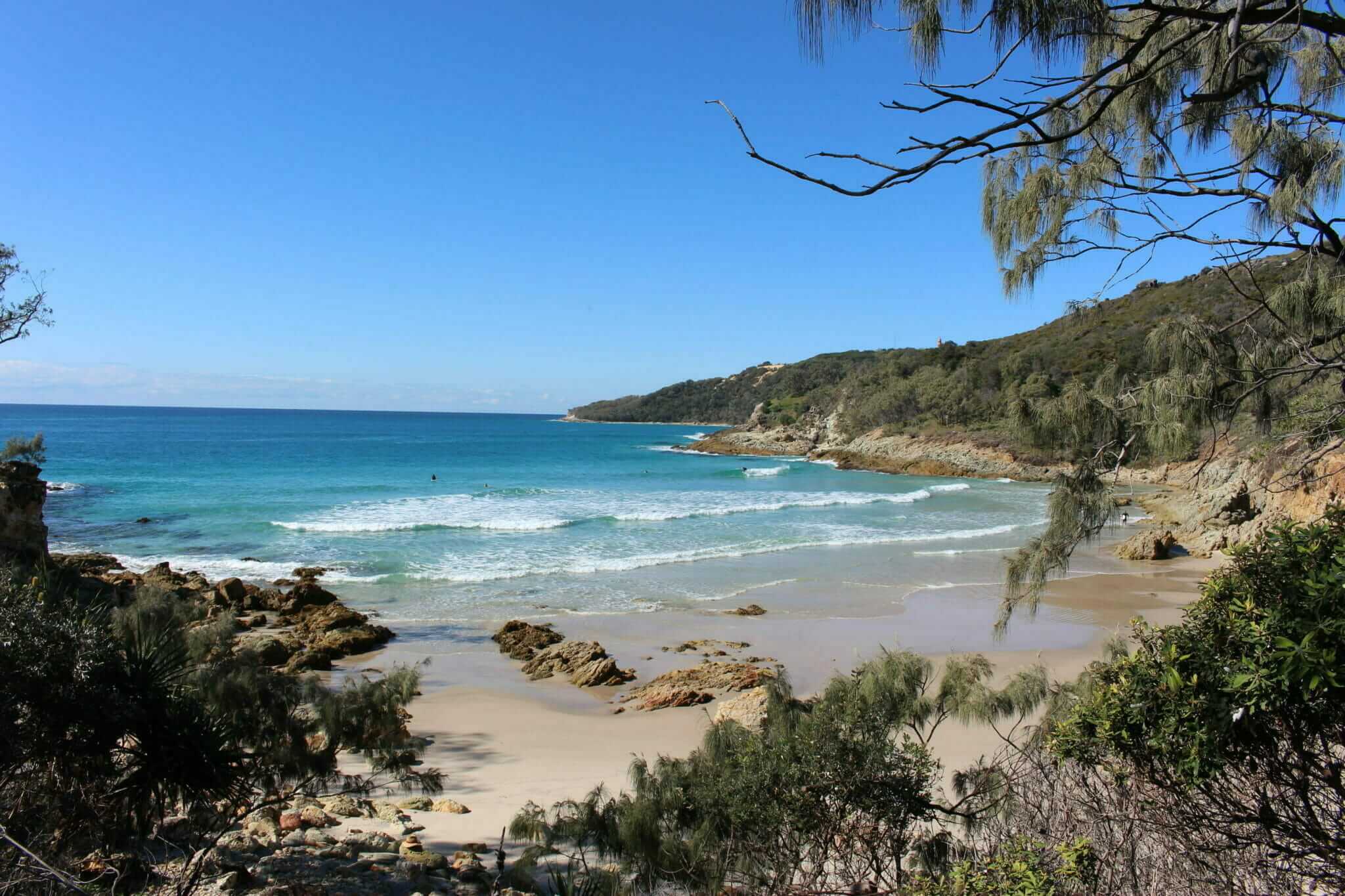
A rocky headland runs from Cape Cliff to North Point, and here at the northernmost end of the island, there is a band of volcanic rock and sandstone, which form a break wall from the Pacific. On the beach side, there is a water pool with a sandy bottom. Waves cascade over the rocks, foaming and bubbling, giving the crystal clear water the aptly named Champagne Pools.
The water was colder on this side of the island, but the boys and I still went for a swim. A few other kids were swimming, but no one could stay in too long. We followed a trail to a protected cove called Honeymoon Bay. Lined by 15-metre-high cliffs, the beach is completely hidden, perhaps why the name was chosen. If you’ve ever seen the movie Blue Lagoon there are certain scenes from that movie that can happen here. Known for its eastern-facing rips and strong seas, I didn’t let that bother me too much and went for a swim.
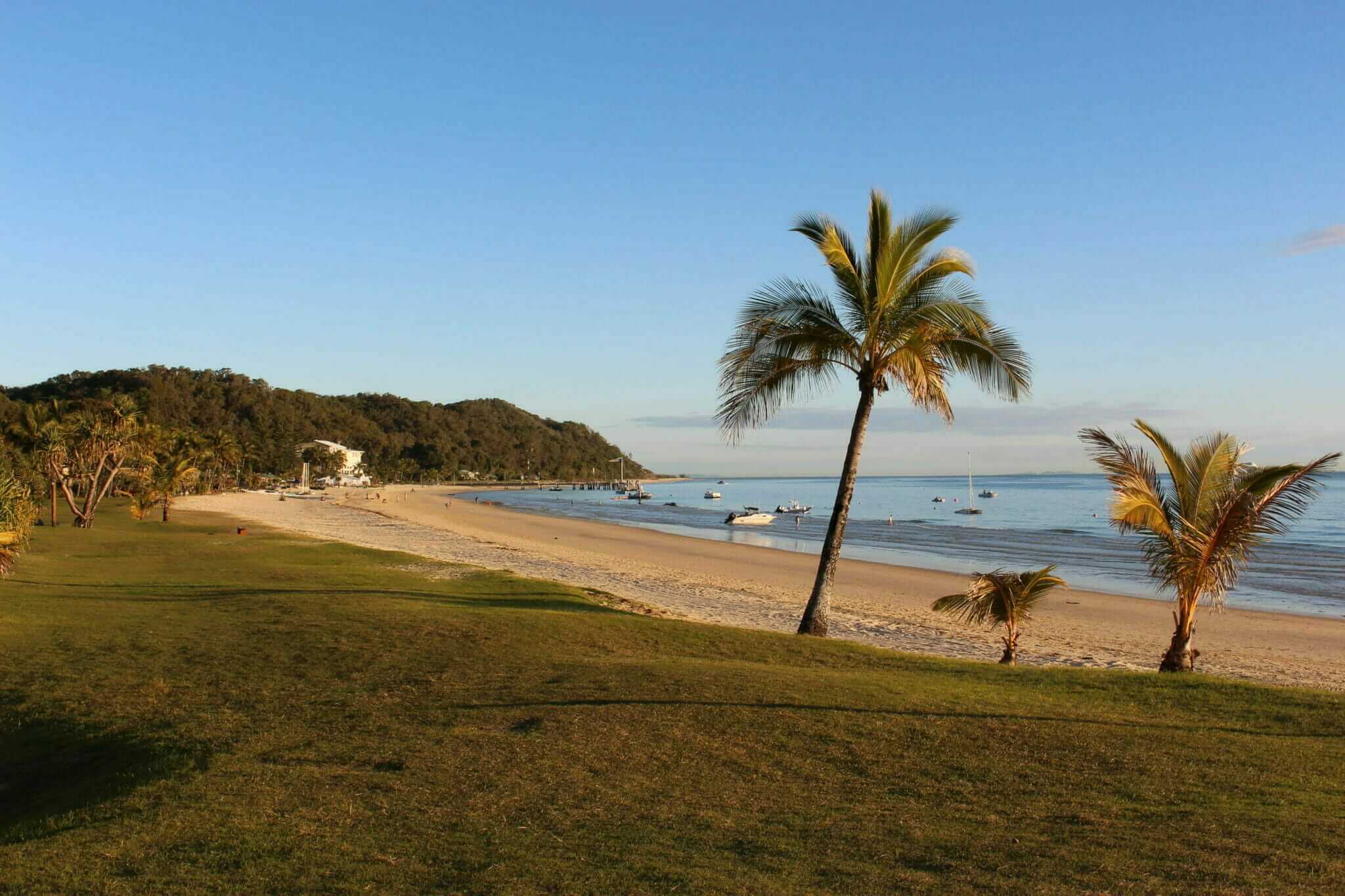
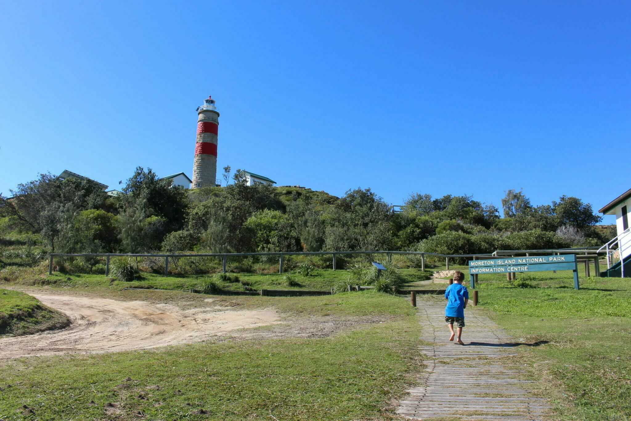
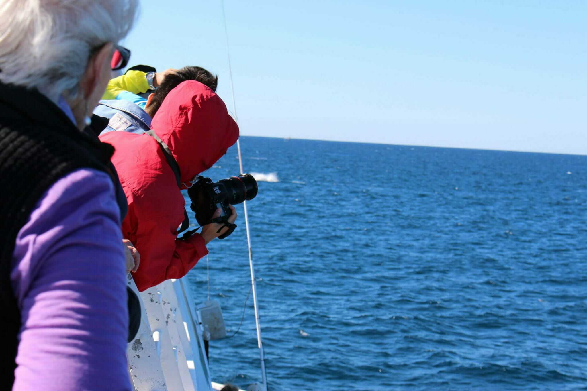
After a few hours of sun and surf, we hiked back to the FJ and decided to check out Cape Moreton Lighthouse. From the North Point campground, it’s a short drive to the parking lot. The Moreton Island National Park Information Centre is also located near the lighthouse in one of the old keeper’s cottages and contains lots of great insight into the island’s geological history, flora and fauna. We followed a path around the lighthouse and took in the stunning panoramic views of the island, the never-ending sky and the ocean. From here we watched as the Tangalooma Jet followed a school of humpbacks in the distance.
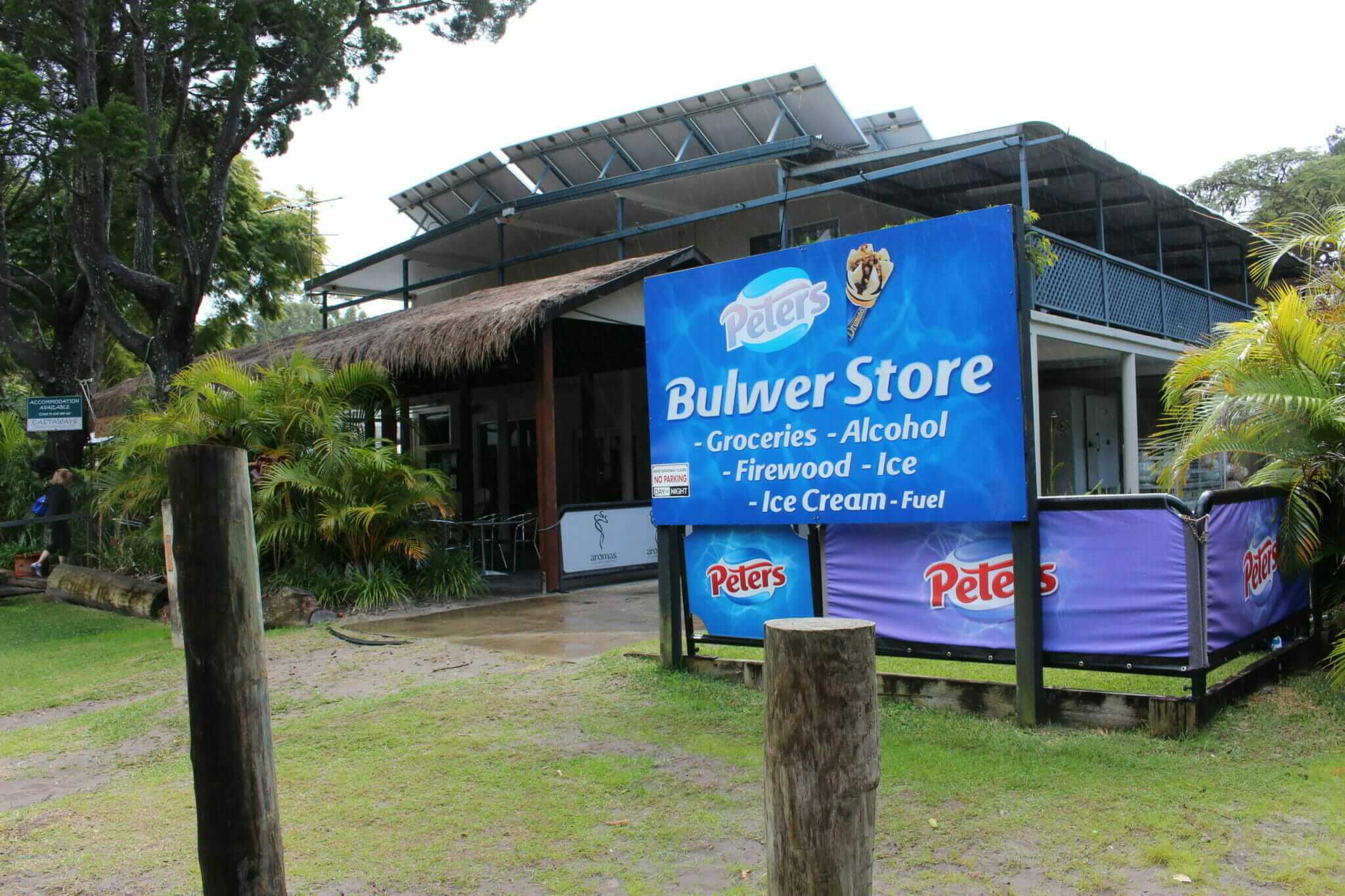
We ended the day trip with a stop-in at Bulwer, a residential town on the western side. Established in 1848 as a pilot station the town was named after Edward Bulwer Lytton, a British MP. At one time a small community with a school (until 1909), Bulwer is now a holiday and fishing village, with a small convenience and liquor store, taxi service, public phone and bait & tackle. After driving around in circles, we finally found the Bulwer store, but as it was Tuesday it was closed. I had promised the boys ice cream, so this was met with wild objections!
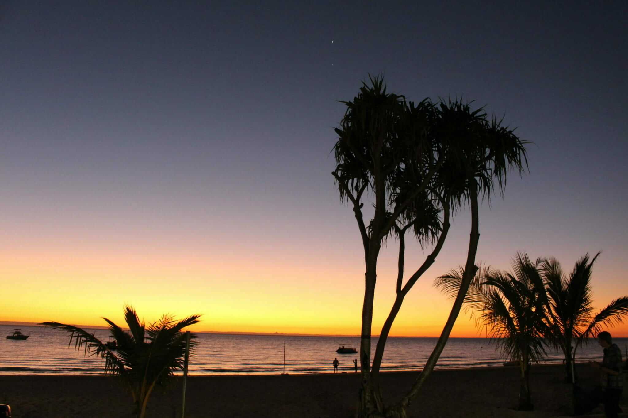
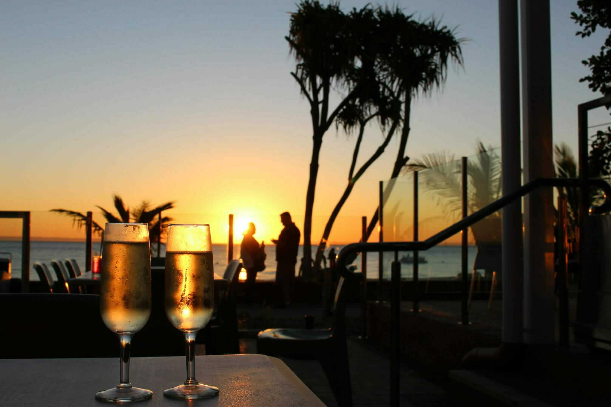
Back at Tangalooma by sunset, we found a nice spot on the veranda of the resort café and with two glasses of champagne, watched the sky turn rosy pink, blood orange and finally a deep purple as the sun sank behind the black silhouette of the mainland.
Dramatic sunsets over water tend to change a person a little bit. I had spent the majority of the day looking at the horizon, searching for that place where the water met the sky. Watching the interplay between the sky and the water at dusk, I noticed that it’s only during the day that the sea and sky are separate. As soon as the sun begins its descent, the horizon blurs, becoming almost indistinguishable, where the sky ends and the ocean begins to cease to exist. And once the sun has set, black night drowns out any division. The only delineators are the stars and when the white face of the moon rises, its murky reflection demarcates the line for a few brief moments until it too rises into the sky and leaves the water and sky to merge into each other once again. If you’ve ever been swimming on a moonless night, the only word that comes to mind is oblivion.
Which got me thinking about the idea of the horizon. The word in itself has a limitless number of meanings, both as a geographic line, but also as a metaphor for the type of life you want to lead. There are horizons outside and within us. I suppose it’s up to us to figure out where to look and how far we need to travel.
Resort Life, Island Time
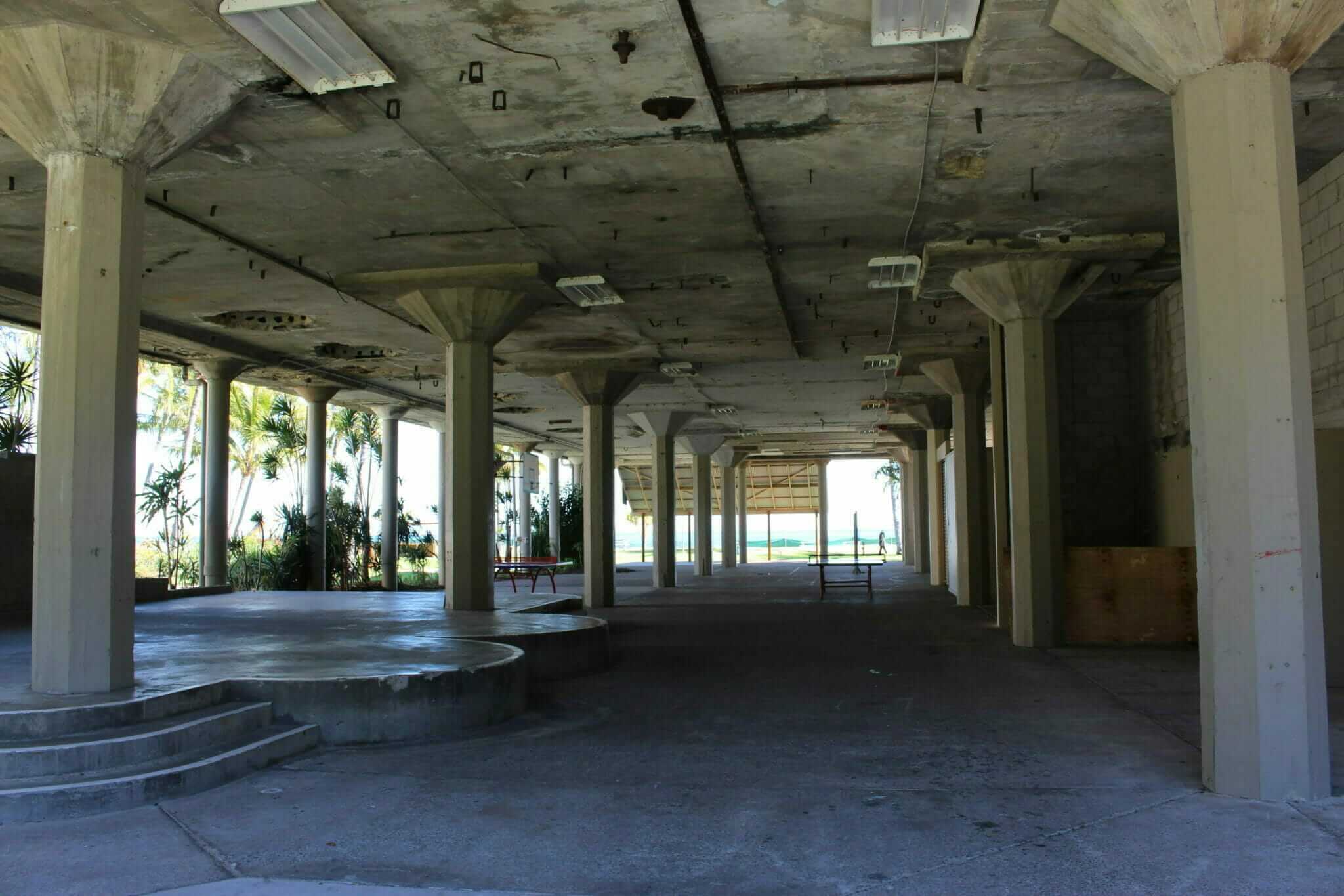
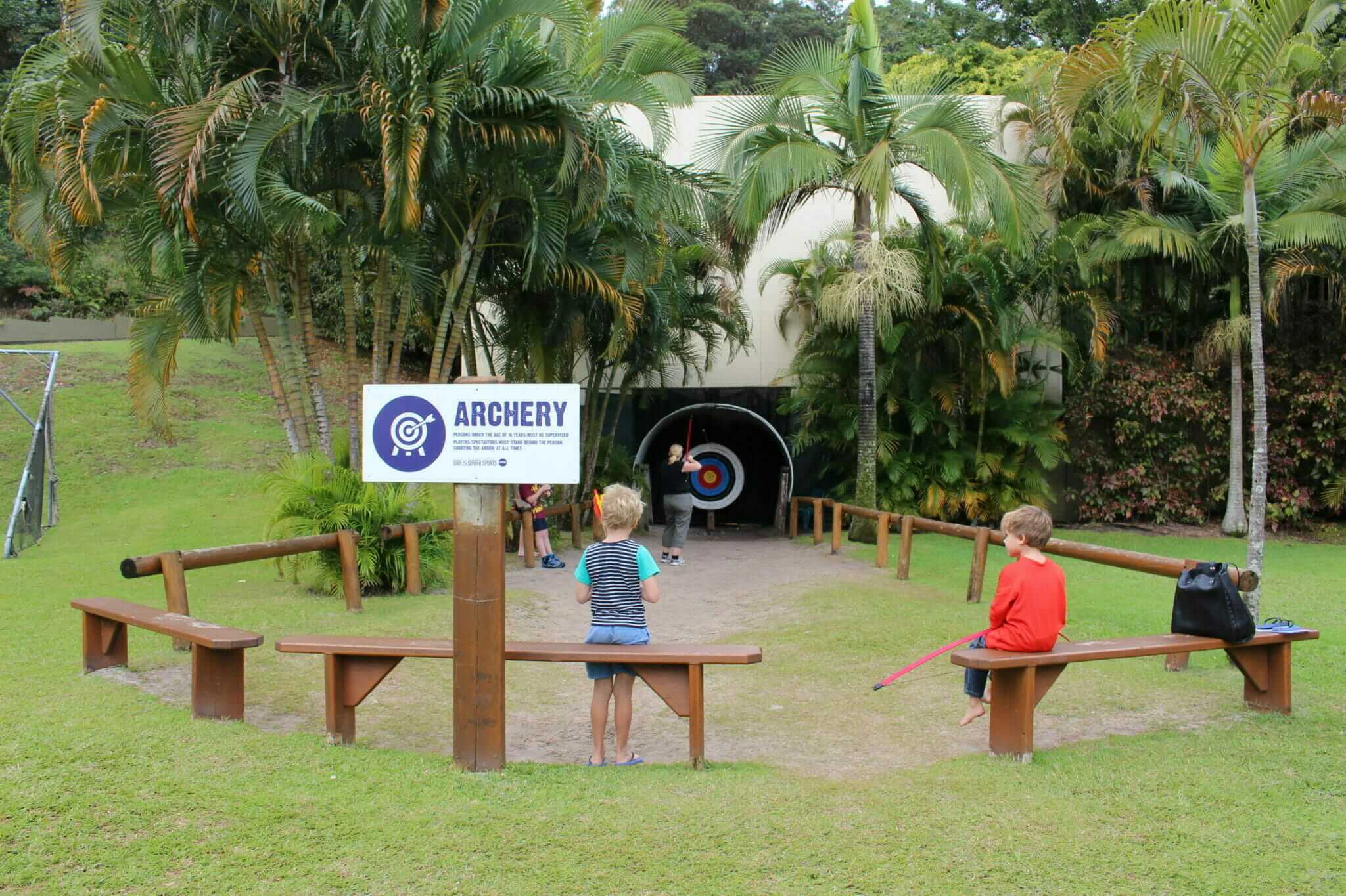
The next day I was forced to sit still and enjoy the amenities of the resort. We took a whale-watching tour on the Tangalooma jet, fed the wild dolphins at night, attended lectures in the ocean conservatory centre, played croquet, golf, archery and even went snorkelling. The shallow beaches and lack of vehicular traffic inside the resort, allowed for stress-free kids’ play. Under the old, dilapidated roof of the former whale flensing station, there was a basketball court, ping pong tables and lots of room for the boys to run when it rained. The resort was set up perfectly for families.
By the fourth day, I was itching to get in the FJ again, so despite my mum’s objections, we headed inland towards a place called The Desert. Not far from the resort down the Middle Road, the turn-off leads to a strange clearing in the bush consisting of several steep dunes. I had to give my mum some credit, the landscape, especially here, really did look like snow. And you can rent toboggans to slide down the dunes or just bring your boogie board. The weather was not on our side, however, and it soon began to rain. We raced back to the FJ and headed back towards the eastern beaches. I wanted to head south to find the remnants of the Rous Battery.
But the weather was working against us – a strong gale blew from the southeast and I watched nervously as the high tide forced us into the soft sand and my fuel gauge began its steady descent towards E. We couldn’t find the Rous Battery in the dunes so I lost interest in our southern journey. We turned back north instead and decided to look for Spitfire Creek. There was supposed to be an Aboriginal midden here and I thought we might find that instead. We parked at the creek and had lunch, no midden to be found and the weather only worsened, so we decided to go back to the resort. A rainbow formed over the ocean in the storm clouds, which I was able to snap a few shots of before the rain came down. The rest of the week was a washout, which meant I never did get to spend the night in our brand new James Baroud rooftop tent – but on the flip side, we stayed high and dry and cosy warm in our two-bedroom unit above the swimming pool at the resort!
Escaping to an island is the penultimate myth – on an island, we are protected and buffered by the ocean, and from this remote and removed place, life seems suddenly simpler. We escape the banality of day-to-day, and move into the future tanned and smiling, walking along the shoreline frozen in timeless simplicity. But as I said previously, this is all a myth. Eventually, we must go back, and no matter how far we run, we can never really escape ourselves.
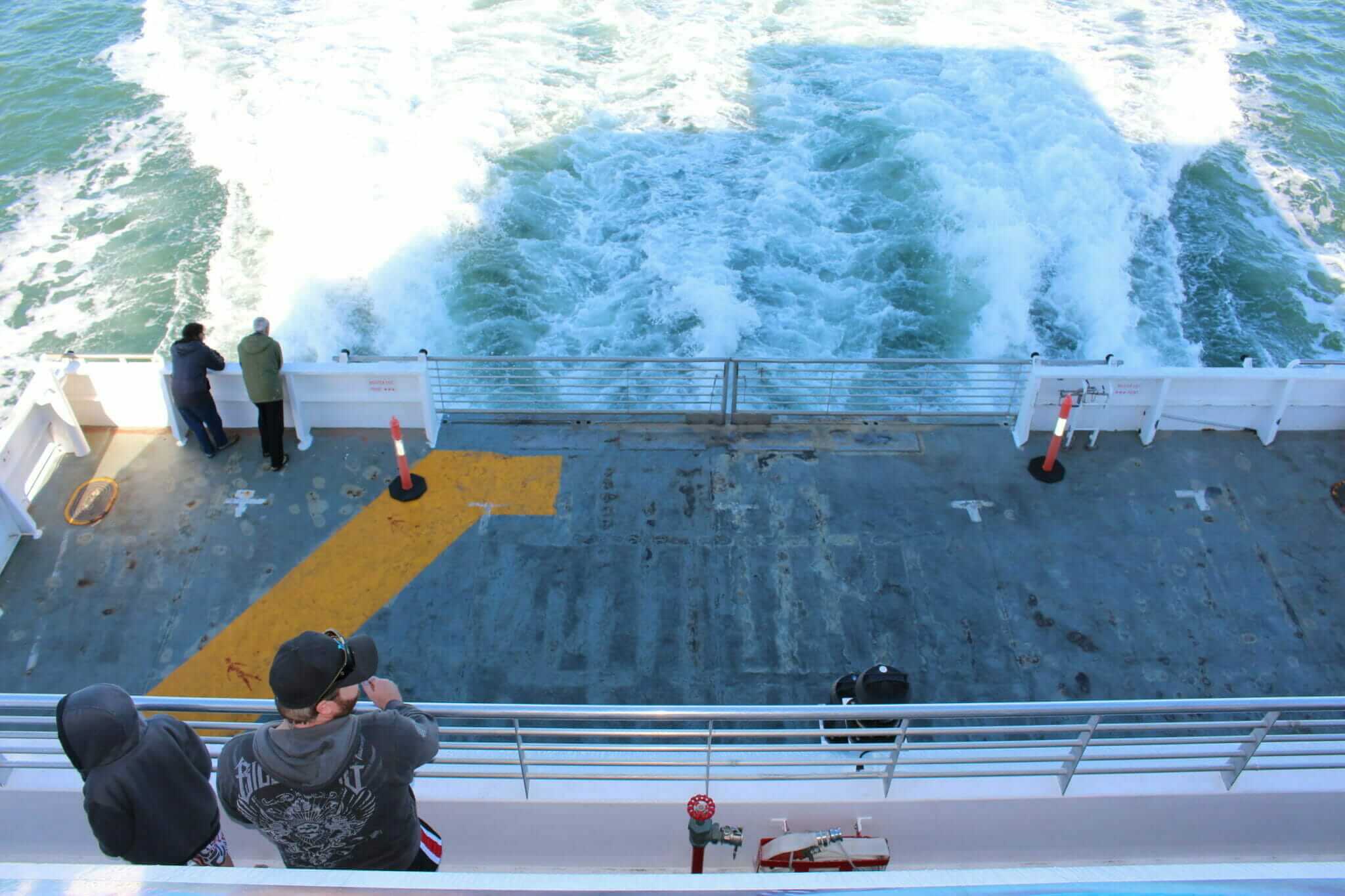
By the end of the trip, my Mom was a little less tense whenever we took off in the FJ. She stopped worrying about the sand piling up on the floorboards and the idea of snakes waiting for us if we ventured too far into the dunes. And once we were safely on the deck of the MICAT sipping hot tea and watching the island slip away into the distance, she even managed to laugh and smile and tell me what a nice time she had. On this trip, I had wanted her to let go, to fully embrace the adventure. And although she rode around with me, she never did get in the ocean and let it wash over her face. Life was never going to be perfect or safe or predictable. But what it was and would always be was a beautiful mess that must be enjoyed in the present. I don’t know if she took that realisation away with her, but I like to think she did.

Before You Go:
MICAT Rates: For one 4WD with four passengers the cost was $199, plus $50 for a vehicle access permit to drive on the island.
Tangalooma Island Resort: our room was $125/night and contained one bedroom, three single beds, one full bed and a full kitchen and bathroom. This included feeding the dolphins for one night. The whale-watching cruise was an additional $220 for 2 adults and 2 children. www.tangalooma.com
Guides: Brad McCarthy’s Dirty Weekends, Hema Maps Moreton Island map app
Trip highlights – whales, dolphins, sand tracks, champagne pools, Honeymoon Bay and watching the sunset over Moreton Bay each night!
Trip Tips:
– 4WD vehicles with high clearance are a must for driving on the island. All vehicles should be equipped with recovery gear (tyre pressure gauge, shovel, snatch strap, tow rope or traction pads) as there are no recovery services available.
– There is no fuel available on the island, so be sure to fill up at the service station before you enter the MICAT parking lot. Jerries are a good idea if you plan to stay for longer than a few days.
– There is no pharmacy or doctor on the island. The Queensland Ambulance Service operates an office at Tangalooma Resort and has trained paramedics available. Bring adequate supplies of any prescription medication you need and a well-equipped first-aid kit.
– Bring your own water and containers. Water can be collected from the Big Sandhills on the western beach, the Rous Battery and Eagers Creek on the eastern beach, and also at all established campgrounds
History of Moreton Island and the Tangled Tale of Tangalooma Island Resort
– Moreton Island is a 38 km long sand island approximately 40 km from Brisbane via MICAT.
– Most of the island is both a national park and recreation area with the waters around the island also protected as part of the Moreton Bay Marine Park.
– Named Cape Morton by James Cook in 1770, it wasn’t until Matthew Flinders came along in 1799 that the island became known as Moreton Island.
– First Nations people inhabited the area for at least 2000 years, the Ngugi people, a clan belonging to the Quandamooka group, used Moreton Island, which they called Moorgumpin. In 1825 their population was ravaged by smallpox, in 1833 soldiers stationed on North Stradbroke Island staged a massacre, and in 1850, the remaining survivors were moved to North Stradbroke Island.
– The northern end of Moreton Island became the main passage to Brisbane so in 1857, convicts built Queensland’s first lighthouse from local sandstone.
– Major coastal defence bases were constructed on the island during both world wars.
– Queensland’s only whaling station operated at Tangalooma from 1952 to 1962.
The whaling station was closed and purchased by a consortium of Gold Coast businessmen in June 1963. Now the resort operates whale-watching tours and educates visitors about marine conservation.