Lost in Time: A Journey through Southeast Queensland’s Mystical Glass House Mountains
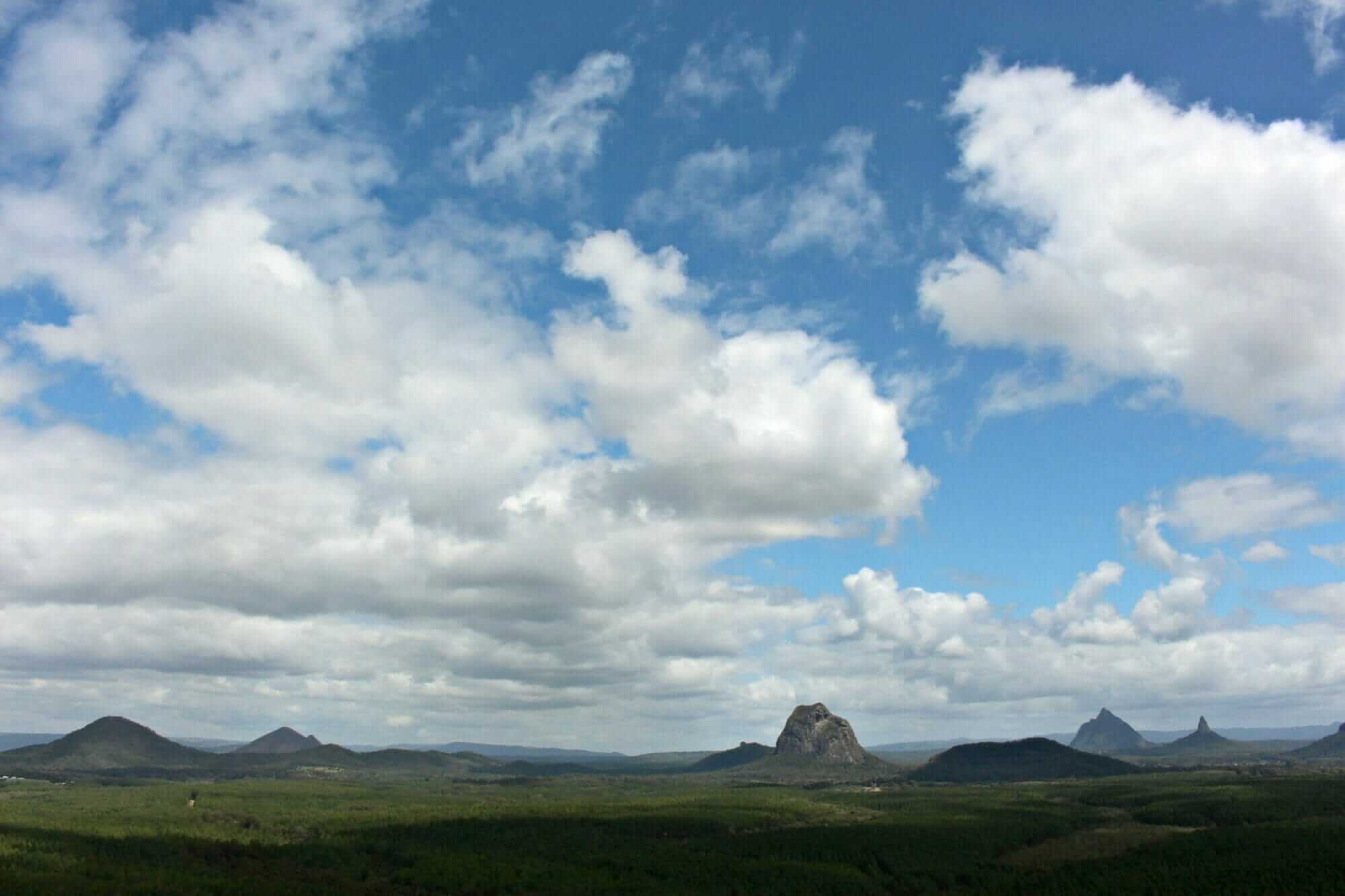
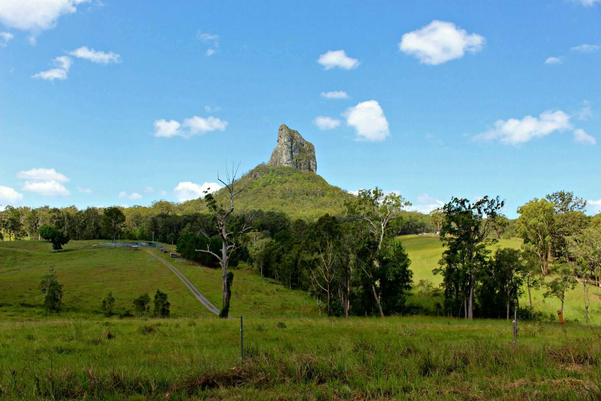
The Glass House Mountains are located about an hour’s drive north of Brisbane and are composed of eleven iconic rocky hills or volcanic plugs. Remnants of volcanoes active over 25 million years ago were named the ‘Glass Houses’ in 1770 by Captain James Cook due to their resemblance to glass furnaces back in England. Columns of comendite from quickly-cooling lava, these mountains have been and continue to be the sacred domain of the Jinibara and Kabi Kabi people, whose origin story involves a family dispute.
Using Brad McCarthy’s SE Queensland Bible, Dirty Weekends, we took a relatively easy off-road long weekend to check out the dirt tracks winding through these ancient rock formations.
Travelling Through Time
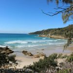
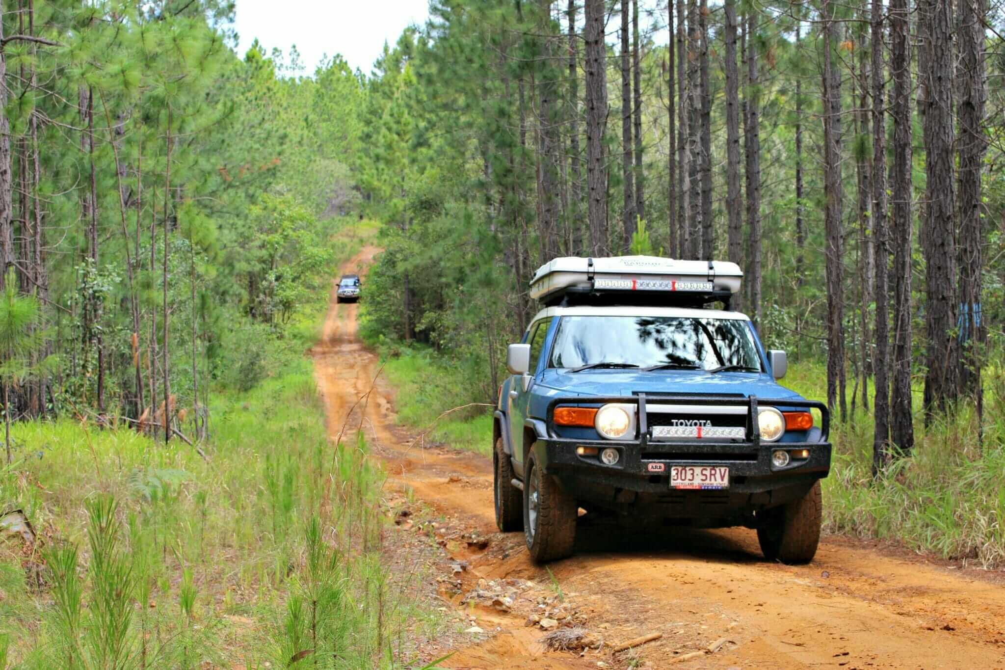
It’s hard to imagine what Southeast Queensland looked like 25 million years ago—but there is something mesmerisingly prehistoric about the landscape around the Glass House Mountains. A maze-like series of dirt tracks winds through the pine plantations around the national park, offering glimpses of the iconic rocks, muddy water holes, and rutted hill climbs. The trip takes about one to two days and is easy to moderate, 4WDing depending on the amount of rain in the area. There is only one camping area at Coochin Creek, so we arrived the day before, visited the seaside town of Toorbul for a playground and a swim, and spent two nights at the campground.
The following day, we started further south, at the Caboolture River Bridge along the Bruce Highway (about 45 minutes north of Brisbane) on a bitumen road heading towards Elimbah. Following Dirty Weekends’ trip instructions were confusing due to the number of tracks in the area. It’s also a popular place on the weekends with not only 4WDers but dirt bikers, which can make it a bit chaotic but also an excellent opportunity to see two wheels tackle the tracks.
The journey takes you past the rocky shoulders of Mt. Tibrogargan and the pointy spire of Mt Coonowrin, two of the most iconic peaks in the park. It also leads into the very touristy section of the national park to beautiful look-outs, past historical places such as Bankfoot House, constructed in 1868 to provide accommodation for the Cobb & Co coaches running between Brisbane and the Gympie goldfields, and the remnants of Campbellville, a mill town founded in 1881.
We got joyously lost in the 4WD tracks, relying on GPS to find our way back to the bitumen, waiting for the rocky peaks to pop up from behind trees or hills as we navigated through the pine plantations. There were a few good creek crossings and deep mud puddles, but mostly dirt tracks. The driving was easy but very rough and bumpy at times, and the muddy bits and steep climbs were enough to get the heart pounding but not challenging enough to require any recovery operations.
Bora Ring
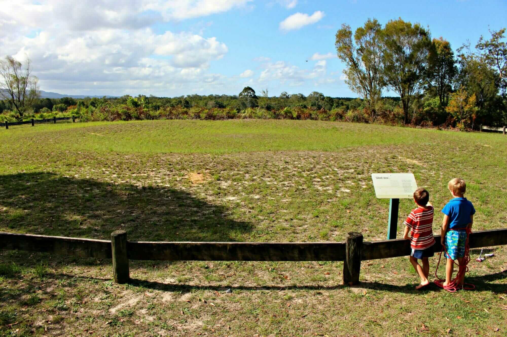
The journey’s highlight came near the end of the second day after visiting the Matthew Flinders rest area. About 4km further down is a fully intact Aboriginal Bora Ring. At one point, this circle, constructed of raised earthen embankments, was most likely a metre high. Bora rings were usually constructed in pairs, with a bigger circle of about 22 metres in diameter and a smaller one of about 14 metres. The rings were joined by a sacred walkway, but this ring was the only one left.
They are the sites of the sacred Kippera ceremony, where young males were initiated into full manhood. The male initiates were led along the sacred pathway from one circle to the next. The word ‘bor’ is believed to mean the girdle of manhood worn by the young initiates, and ‘kippa’ means young man. Only a few remaining bora rings remain in Australia, and due to their fragility, it is essential not to walk on the site. There is also an intact bora ring at Toorbul Point, about twenty minutes east towards the coast. Bora rings are sacred Aboriginal sites and must be treated with respect.

Glasshouse Mountain Dreamtime
Mt. Tibrogargan, the father and Mt. Beerwah (highest peak), the mother, had several children: Mt. Coonowrin (the eldest), Tunbubudla (the twins), Coochin, Ngungun, Tibberoowuccum, Miketeebumulgrai and Elimbah. Tibrogargan noticed that the sea was rising and called out to Coonowrin to help his pregnant wife gather the young children together so that the family could flee from the rising water.
Coonowrin ran away in fear, and Tibrogargan, incensed by his son’s cowardice, followed and struck him with a club that his neck was dislocated. When the seas retreated, the family returned to the plains. Conowrin, teased about his crooked neck and ashamed of his behaviour, went to Tibrogargan and asked for forgiveness, but his father just wept with shame.
Conowrin then approached his brothers and sisters to ask forgiveness, but they, too, could only weep with shame, thus explaining the area’s many small streams. Tibrogargan then called Conowrin and asked why he had failed to help Beerwah. He explained that he felt she was big enough to look after herself, though he did not know she was pregnant. Tibrogargan then turned his back on his son and still gazes out to sea today, refusing to look at his son, who forever hangs his crooked neck and cries. The mother, Beerwah, is still pregnant, as it takes time to give birth to a mountain.

Coochin Creek Camping
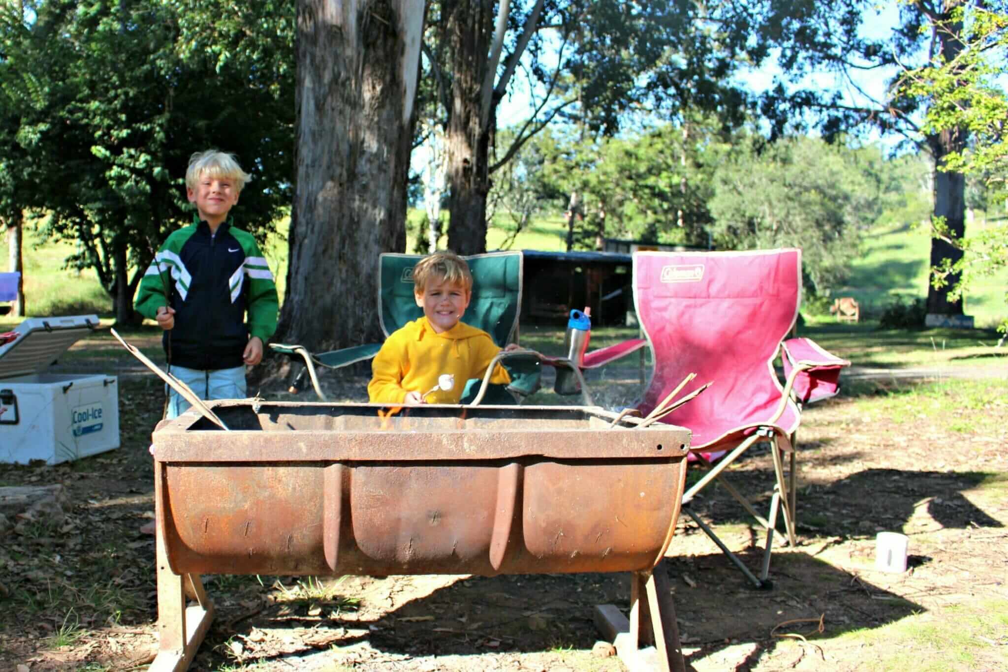
The Coochin Creek camping area was the final destination on our Glass House journey. It’s a lovely little campground off Roys Road, about 3km from Pumicestone Passage. The 21 available sites for tents, caravans or motor homes must be booked in advance. There is also a boat ramp and access to Coochin Creek, which is great for fishing and swimming. Amenities include fire rings and composting toilets.
Camping
Coochin Creek Camping Area, Glasshouse Mountains
Beerwah State Forest, Roys Road
21 campsites, toilets, water (no drinking water), fire rings and creek access